Friday, August 13, 2010

Falling Waters Trail

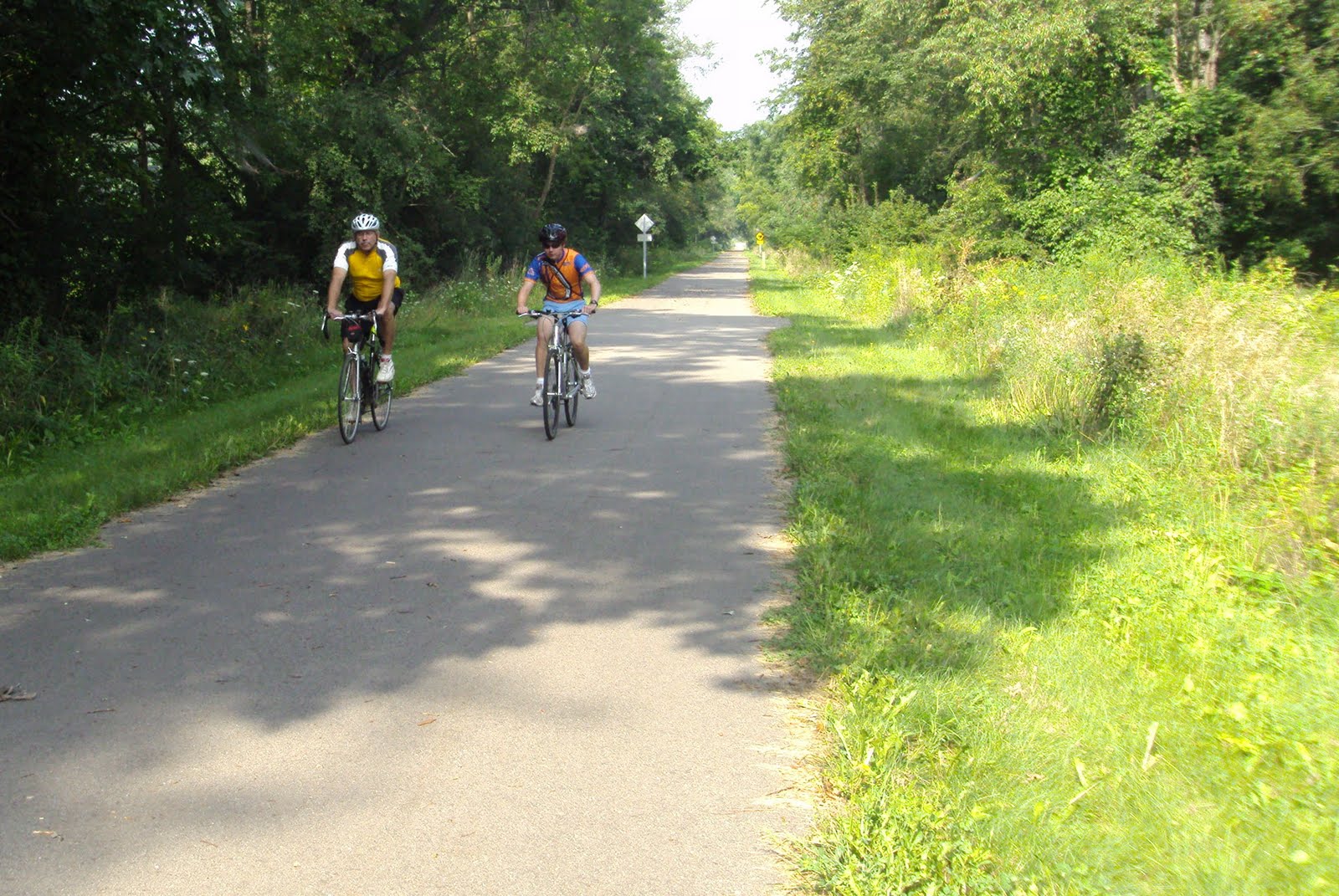
Dave’s been complaining that he’s the only one posting to the blog, so I promised him that I would post from our ride today. Pales in comparison to his mountain climbing exploits….but it was still a lot of fun! Cousin Alex was visiting us and it seemed like a good time to ride the “Falling Waters Trail” that runs from Jackson, MI to Concord, MI…. a distance of about 11 miles. It’s a converted rail bed, paved, flat and wide enough to comfortably ride three abreast. http://www.fallingwatertrail.org/ The trail goes right through the middle of Lime Lake and by Spring Arbor which is where the parents/grandparents live. So we rode the entire trail, doubled back and then took a detour off the trail to go visit them. While I worked on fixing Mom’s computer issues, Mike and Alex did an additional six miles up and down surrounding hills. Plus, they were talking so much that they “missed” Lime Lake, and had to see it before looping over to the folks. So overall, I did about 24 miles to their 31. It was a pleasant ride….not too hot and the flat terrain was a nice change from what we usually experience.


We borrowed a bike for Alex, so had to spend time fitting it at the trailhead


starting out along the trail in Concord


There are fields on each side, so you see this sign every little while


scenery along the way


There's places to stop and rest along the way. This spot is right on Lime Lake (that's not us)


Lime Lake


you can see Lime Lake on both sides in this picture


pausing at the Jackson trailhead....it does continue on to a "city trail" which goes through Jackson. Someday we'll ride that too.


Trail head in Jackson


Grandma took this and didn't cut off our heads! : D

Sunday, August 8, 2010

On to New Heights!

After I climbed to 10,000 ft. on Mt. Rainier, I started to having something like remorse going through my head. I had set a new altitude record, an excellent achievement, but then the reality set in that at this present time I can’t climb any higher. To go any higher essentially requires two things, neither of which I have: mountaineering knowledge, and a climbing partner.

So that left me wondering what’s left for me to accomplish this summer. Then it occurred to me that though I had climbed to 10K on Rainier, and 7300 ft. on Baker, in both cases I have yet make the summit. Thus the highest summit I have stood upon is Mt. Defiance, at just 5584 ft. above sea level. That leaves me with plenty of room to grow in terms of summits conquered. So yesterday I set my sights in Granite Mountain, which is part of the group of peaks surrounding my old favorite Mt. Bandera. So here now is the tail of my adventure.

The trail starts off really easy, so much so you almost forget you’re on a mountain side. The sky overhead was completely overcast, making for a relatively cool hike. After around a mile it splits in two, with one path leading to the summit, while the other leading to some lakes. Upwards I climbed towards the summit, and from this point on the trail alternated from grueling switchbacks to easy trekking and back again. Just an hour into the hike I reached the first of the avalanche chutes. Breathe easy Mom, there isn’t any snow on the mountain this time of year, so it was completely safe. From this point on, the trail alternates between being under forest canopy and open ground. If there was any view to see it was at this time I might have been able to get my first real glimpses of it, but, alas, the clouds covered everything in a gloomy grey.

After about 1 hr. 45 min. or so the trail leaves the forest and travels along open steep meadows, filled with wild flowers and a few scraggly trees. Just a few minutes after I hit the open face it began to rain, and I was obliged to stop and put on my raingear. After some switch backs I reached a level space of ground with several trails going in different directions. The trails all more like deer paths through the grass than the well maintained and wide trail I had been hiking until now. Not knowing where to go, I selected a path that seemed to go upwards towards where I assumed the summit was, but I didn’t know for sure because the clouds prevented me from seeing more than perhaps two or three hundred feet at best. It wasn’t long before the trail started to climb a ridge. I could see glimpses of the valley on the north side, and the open face to the south. Just after noon the trail became a boulder scramble, which means there really wasn’t a trail at all!

Now, bear in mind that Granite mountain is one of the most heavily traveled hikes in the Snoqualmie area. When the path became an unintelligible scramble, it didn’t fit with the picture of hundreds of climbers a weekend. Because of the foul weather I had only seen a few people, so I couldn’t follow someone who already knew the way. So here I was, stuck in the rain on a pile of rocks that seemed to go up forever, and with no trail to follow. So I decided to stop and take lunch. While I was cooking my Ramen noodles, I consulted my map to see where I was. I had thought that perhaps I was climbing a subsidiary peak, but my map suggested there was none. However, in a stroke of luck, I spied through the clouds a trail in the valley below, and even a few hikers traveling along it. After wrapping up my meal (eating my noodles very carefully with my knife, because I had forgotten my spoon), I doubled back and found a spur that descended to where I had seen the trail, and discovered that trail was the main one after all.

From there it was just another 30 minutes to the top. As I hiked I could make out the ridge I had been on, and realized it led all the way to the top. I could have stayed on it if I wanted to, but it wouldn’t have been much fun. At the summit was an old look out, and I’m sure on a better day there would have been an astounding view, but since the clouds dominated everything, there wasn’t anything to see. But I had reached my goal of climbing to a new highest pinnacle. Granite Mountain stands at 5629 ft., just 45 feet taller than nearby Mt. Defiance, but that that’s all it takes to keep going up. My next goal is to climb a mountain that is 5700 ft tall, and then climb mountains that are each 100-200 ft. taller than the previous one. A cursory glance at my hiking books suggest that this might be Sasse Mountain (5730ft) or Mt. Dickerman (5723ft), the latter being a well regarded climb.

Well, there wasn’t much to photograph on Granite mountain, but here are a few dreary pics.


Wednesday, August 4, 2010

Cathcing Up

Oh man, I'm sooo far behind in reporting my hiking adventures. I have been so busy lately, but now summer is on in force and I have a chance to catch my breath. So in this posting I’m going to give a brief rundown of all my hiking for the past couple of months, and then post a few pic at the end.

My last report was about my first expedition to Mt. Rainier. I have since made 3 others, and I plan to make, hopefully, 3 more over the next couple of months (I’ve got to get my money’s worth for my pass; next year I’m buying a Rainier only pass, not a full NP pass).

As most of you know, I’ve been dealing with some extreme hearing issues. Because of that reason, and others, I’ve had to stay behind and not join the Mt. Rainier team this year. They climbed the mountain this last weekend and I’ve not yet heard how it went. I hope to join them next year, or the next time they climb, and I make my summit bid when the time is right. I have peace about all this, believing it was a word from God to not go.

When last I wrote I had reached a new high altitude record of 7500 ft. My second Rainier expedition allowed me to get to about 8500ft before I started feeling “off”. 8000 ft is where altitude sickness can first kick in, but I think I was more just out of shape and carrying too much weight. The third expedition saw foul weather, but since I was there for a school assignment, that wasn’t such a big deal. I got a perfect score on that assignment by the way. My forth trip, just a few weeks ago, I smashed all my previous records, reaching Camp Muir at 10,188ft!!! It took me five grueling hours and I nearly ran out of water (I descended with only ½ a liter)! On my next trip I plan to carry enough gear to spend the night at Camp Muir.

I’ve had several other adventures too. I hiked up Mt. Bandera with Dad, which was an absolute blast, just because of who was with me. I also climbed Mt. Defiance, which is next door to Mt. Bandera. I found Defiance to be much harder, but much more fun, because of all the deep snow and even some light rock climbing too. I also went up Mt. Baker, a 10,000 footer, but got sick at the high camp at 7200ft and did not summit. And finally just a few weeks ago I returned to West Tiger Mountain, the first real mountain I ever climbed. I ascended that one while I was a student in MCs. When I first took it on in 2005, I was challenged beyond comprehension. When I returned for the second climb, found it WAY WAY to easy! That shows how far I come.

Finally, I would be remiss if I didn’t mention my hike with Jacob Wyatt back in Michigan, where we covered 16 miles of the Manistee River Trail in two days. The return 8 miles took ½ the time as the first 8 thanks to Jacob’s extreme pace, courtesy of his athleticism. I think he would find the mountaineering technique called the “Rest Step” to be really annoying. But despite the brutal pace I found the whole trip to be very enjoyable and relaxing, and the company was superb.

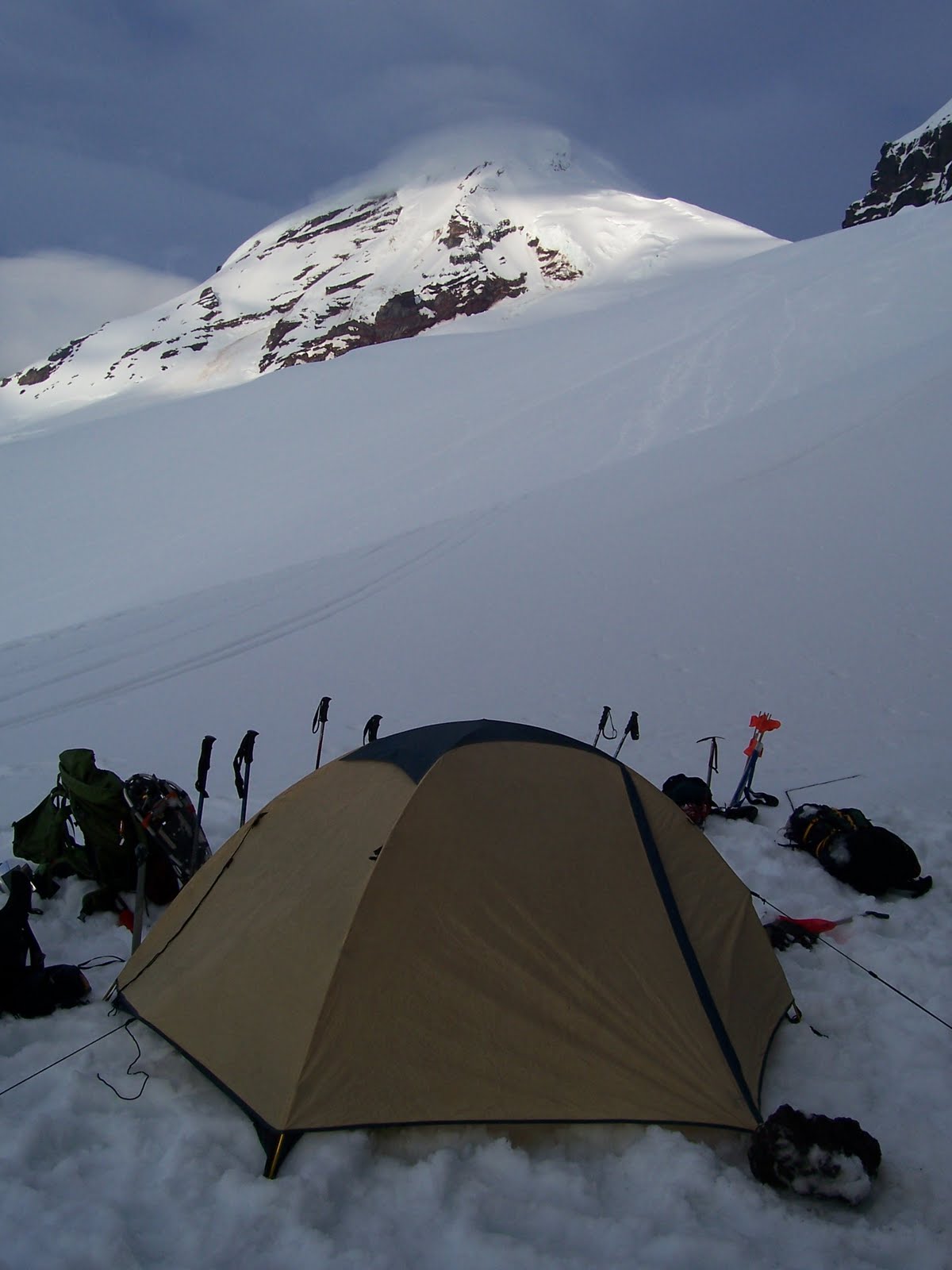
Well there you have it folks. That's a mad dash through all my hiking adventures. So here now is a few photos. The first 3 are from Mt. Baker, the last 3 are from my most recent hike up Rainier. Enjoy.


Wednesday, July 28, 2010

Welsh Summit in Afganistan!

Cool article about a mountain climb in Afghanistan by a Welsh team (with one American too). Check it out.

http://www.bbc.co.uk/news/uk-wales-10758430

I'd like to go on a grand expedition someday. They don't happen too often these days because almost everything has already been summited and there's no real need for another major expedition. But people do still stage them every now and again, even for mountains that don't need a first ascent.

Sunday, May 9, 2010

7500ft!

Yesterday I hiked to what, I believe, is the highest elevation any Cronkright has yet hiked, a staggering 7500 ft. above sea level. I could be wrong though on holding the record (how high was that trail in Hawaii?), but I certainly achieved a new personal best. In fact, I achieved that when I stepped out of the car in the parking lot!

Where, do you ask, was I hiking? Well, I'll tell you. I was trekking up the Muir Snowfield on the flank of Mt. Rainier. I'll post a full description of my adventure in an upcoming post. But for now, I'd like take a moment and give some appreciation the pursuits of altitude.

The more I hike trails and climb mountains, the more I discover what my favorite types of trails are. I'll hike just about anywhere, but Alpine hiking is definitely the pinnacle experience for me. And, while I enjoy climbing all manner of peaks, I find the most excitement climbing the ones with snow on top. For some mountains, this means climbing them only during late fall through early spring. In fact most guide books specifically tell you to only tackle some mountains from June to August (usually to protect the unprepared, but not always). But for other mountains, like where I was hiking yesterday, the snow can always be found if you just hike high enough.

There's just something about suiting up with snowboots and snowpants, and then strapping on crampons (or in my case, YakTrax, the poor man's crampons) and gaiters, and taking on the extreme terrain of the alpine trails. Its magical and charming, yet extreme and adventurous. To feel your feet sinking in the snow, and to experience the radiant wonder of the mountain views, is incomparable. The Muir Snowfield is like the bunny hill of mountaineering, but for me its a place to imagine I'm ascending Mt. Everest, or tackling the Vincent Massif. I feel like I'm a part of some great expedition. Its a taste of whats to come.

In fact, I got a great taste of the future when I reached a certain altitude where the flora disappeared. For the first time ever I had climbed high enough that I was above the treeline. There was nothing around me but snow and a few exposed volcanic rocks. The treeline is what separates mountaineering from traditional hiking. It really was a special moment.

As I said, I'll post a full report, complete with pictures of my climb, and either before or after that I'm going to write another musing on the significance of altitude. But for now, I'll leave you with a little teaser.


Sunday, November 29, 2009

Return to Bandera Mountain

November can't keep me from the mountains! I had never hiked on snow before, but yesterday, as part of a very relaxing Thanksgiving weekend, I decided to take on the base of Bandera Mountain. My goal was to reach Mason Lake via the Ira Spring Trail.


There was a light, soft drizzle for most of my adventure, and after just 45 minutes the trail got even more interesting as I hit snow line. My rain gear held up and my new winter hiking boots handled the terrain expertly. After just a little over an hour on the trail I left the cover of the trees and entered into a clearing that marks the approach to the summit. With the snow much deeper, I quickly put on my brand new gaiters and trudged on. Every tenth step or so I sank in into soft powder, but for the most part the trail was well packed by the snowshoes of previous travelers.


All went smoothly until just a little after 2pm, when it was clear the weather was closing in and my chances of hiking in the dark were rapidly increasing. You see, I only started to hike a little after noon (I slept in way too much), and so I was forced back before things got dangerous. Strangely, six more hikers in two seperate groups were still trying for the summit after me. They almost certainly made their decent after dark. I chatted briefly with one of them, a guy named Xeno, giving what information I could of the trail ahead.

Here are two short videos that I shot shortly after I started back down to the trailhead.


Sunday, October 25, 2009

The BIG Island - - Hawa'ii

A few photos from our trip to Volcano National Park on Hawa'ii. Wil, Krista, Abigail, Ethan, Mike and Lynn, October 2009


the view of Mauna Loa from above the clouds


Abigail is ready to run down the trail!


what a cutie!


Wil running across a lava field


the lava flow across the road

oh, you think?


the steam plume where the lava is hitting the ocean


lava field


we went and saw the lava flow at night....from a 1/2 mile away.
it was hard to take pictures since we didn't have the best camera
for this but these give you an idea anyways


a Ne' Ne'


Wil geo-caching at South Point


We found it!


the LOG


Abigail at South Point


South Point: the southernly most part of the United States (the actual states that is)


entrance to the lighted portion of the Thurston Lava Tube


entrance to the unlighted part of Thurston Lava Tube


inside the Thurston Lava Tube


more inside the Thurston Lava Tube


at the end of the Thurston Lava Tube


Devastation Trail


Abigail getting busy with the camera!


The Steam Vents


view near the "trail of devastation"