Every Mountain is better with snow!
This last Monday, since there was no school (president’s day or something) I decided to get one last climb in before the finals start coming. My thought was that I could get climbing out of my system so I can focus on school (not sure it worked, them mountains looked awfully tempting yesterday). So I headed out to my favorite mountain, Mt. Bandera! This would be my fourth summit, second winter summit, and 7th or so climb in the area.
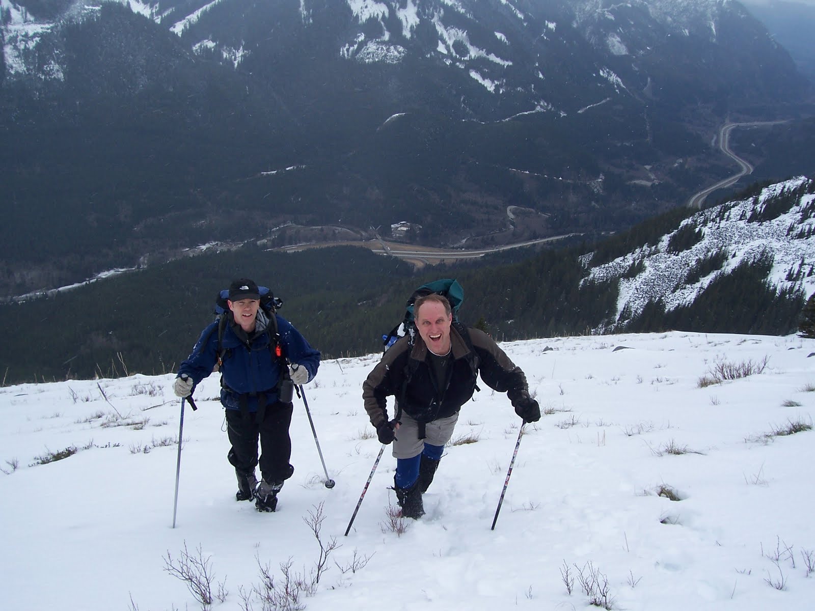
Joining me: my two climbing buddies and super guides, Bruce Hart and Mark Oostra. I really like climbing with these guys. They have tons of experience, with maybe 11 or 12 Rainier summits between them. But here’s the irony of it all: They had never been up this mountain before, so essentially I was guiding them! I thought that was kinda fun.
We headed out at 6am for the trail-head, wanting to get an early start. There wasn’t a single car in the parking lot. The sun was just coming up, and it was partly cloudy. The previous two days had been near perfect, meaning we wouldn’t have to deal with any fresh snow. Once we had our gear on our backs we put boots to the trail by 7:50am.
The trail began as usual, but when we reached the big water fall, we were in for a nice surprise. While they were still flowing hard, the falls were actually partially frozen . It was a spectacular sight, with ice hanging everywhere.
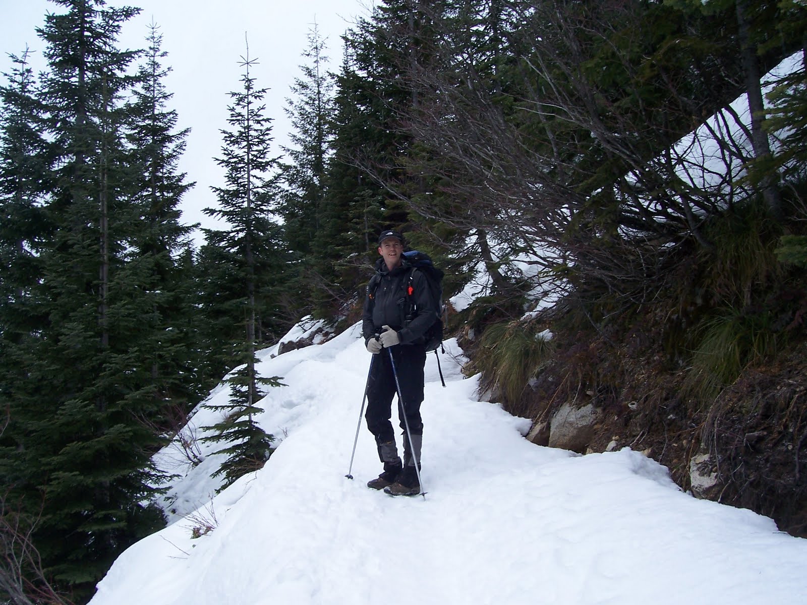
It didn’t take long for the snow to start to appear. Bruce and I put on traction devices for our boots, but Mark didn’t bother. In fact, he climbed the whole day with no extra grip save for his trekking poles. With the extra traction I was able to easily move across the light snow on the trail. This thin layer was steady until we reached the open area about 1500ft below the summit. At that point, the trees largely disappear and the snow get much thicker.
The snow had completely obliterated the trail, which usually traverses under the main south face and then shoots up a steep slope towards the ridge of the mountain. Instead, all there was is a boot path laid down by a previous hiker that cut up towards the col between Mt. Defiance and Mt. Bandera, then veered off towards Defiance to the west. We decided that rather than cut our own trail we would follow this one (even though it went the wrong way). I didn’t know just how far off we would end up until I reached the col and saw the sign for a completely different trail!
The ridge-line was covered by trees, but it was still easy to navigate. So we simply hiked up through the trees, which had deep and soft snow untouched by the wind, and made it to where the trail usually hits the ridge. There we stopped for lunch at an open overlook of the Alpine Lake that sits between Defiance, Bandera, and Pratt Mountains. At this point the weather was beginning to turn. The sun disappeared, the wind began to blow (it didn’t help we were on an open part of the ridge), and the snow began to fall.
While we were munching away, the mountain birds came up to make us share. I didn’t feel like giving them anything, but Mark and Bruce took turns getting them to eat out of their hands, and they even put food on their head to get the birds to land there!!! I had to defend my food fiercely, as these birds were extremely bold.
After lunch was done, we made the final push to the summit, only about 500 feet above us. The mountain has three or so false summits, so you don’t know you are on top until you’re there, but I knew we were less than an hour away. This part of the trip is the toughest, since there are icy, make-absolutely-no-mistake stretches of trail. The wind, snow, and ice made the summit push truly epic. Mark, again with no traction assist, was leading the team at this point, with me behind him to guide and Bruce behind me. After climbing the false peaks, we reached a point where we could go up no farther. Summit!!!
The decent was a little different then the way we came up. For this part I chose to use my ice axe instead of my trekking poles, and found that I really liked travelling that way. We decided to bypass the ridge line partially and come down the steep and icy southwest face, following some markers left by a previous team. Mark and Bruce glissaded down, but I chose to walk down. I’m still not comfortable with that particular maneuver. They did in one minute what took me ten. I took my time and self belayed with my axe as needed. My feet wouldn’t always go into the snow when I took a step, but it wasn’t too tough.
After the face the trek went smoothly, and we were at the waterfall again in what seemed like no time, taking one last round of pictures. It was one of the best climbs I’ve ever done!


The obligatory self portrait.

The always enthusiastic Bruce Hart
Leading the way at the moment: Mark Oostra
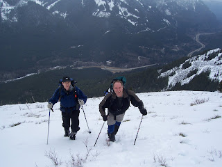
Climbing towards the West Col

Tonight on Fox: When Birds Attack!

Summit Drive